Overview of Sites

Site Details
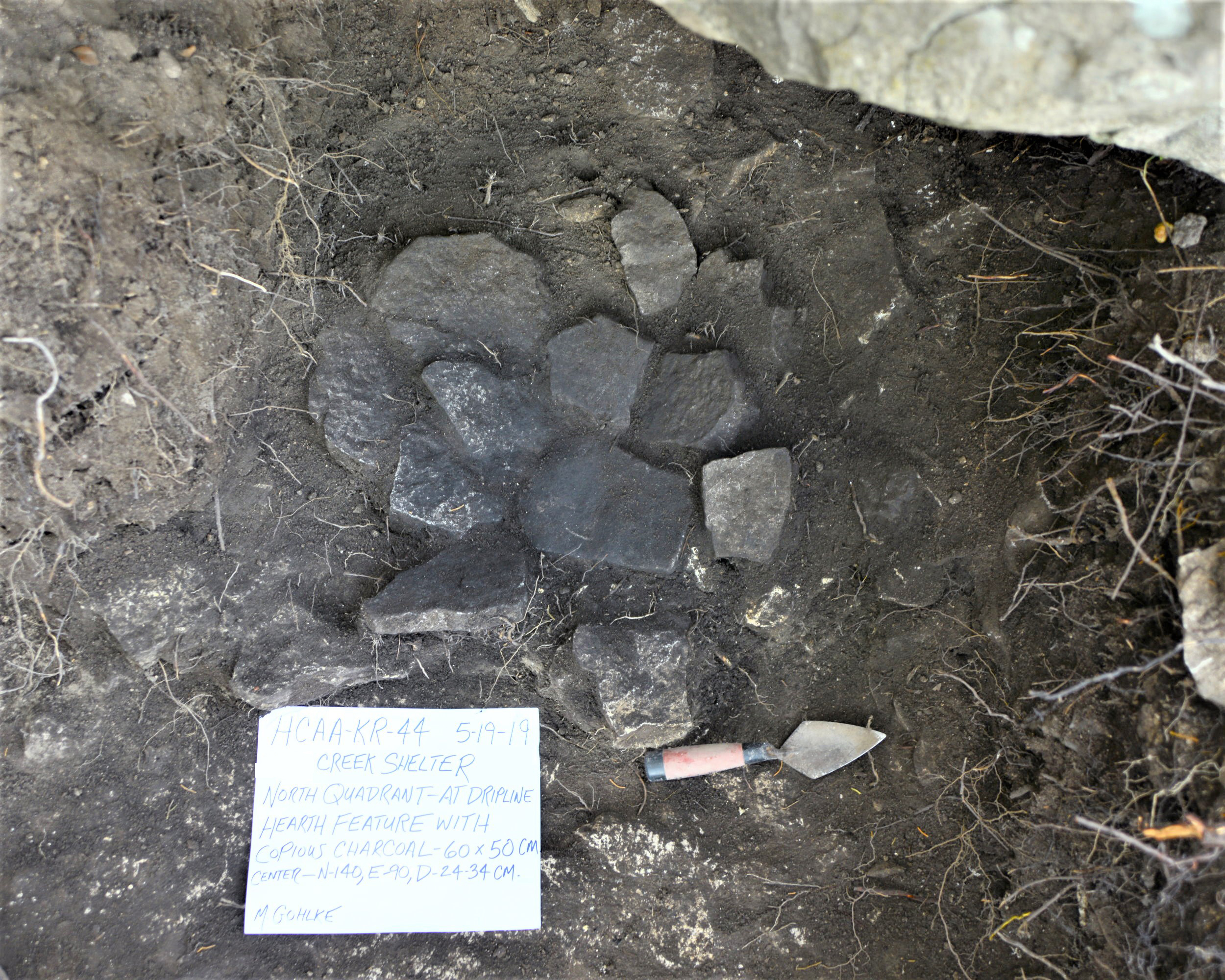
The Creek Shelter Project–HCAA-KR-44 (August 2019)
Authors: Trei and Marvin Gohlke
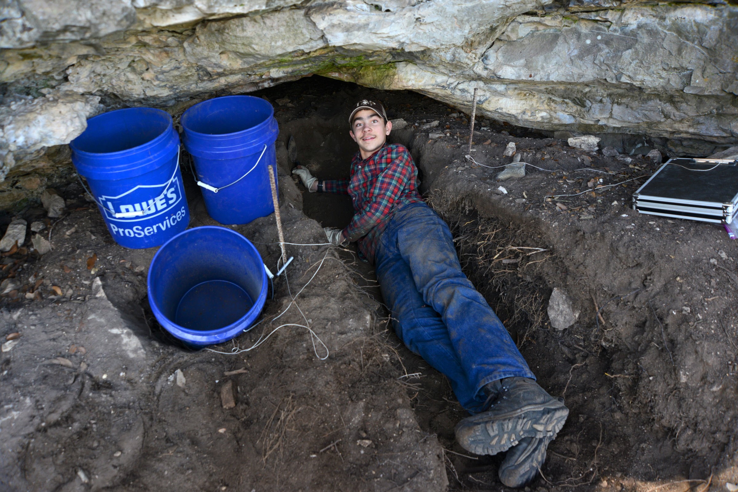
In December of 2018, Marvin Gohlke, Jr. and his son, Trei (Marvin Gohlke, III) were exploring along a bluff above a creek on a new place they had bought in Western Kerr County. This bluff runs approximately 100’ above the spring-fed creek below. Marvin was walking along the top of the bluff while Trei was exploring the ledges just below.
hlke, Jr. and his son, Trei (Marvin Gohlke, III) were exploring along a bluff above a creek on a new place they had bought in Western Kerr County. This bluff runs approximately 100’ above the spring-fed creek below. Marvin was walking along the top of the bluff while Trei was exploring the ledges just below.
“Dad come down here and see what I have discovered”, Trei told his Dad.
“Is it worth me crawling down there to check it out?”, Marvin asked.
“Yes Dad, it is”, Trei exclaimed.
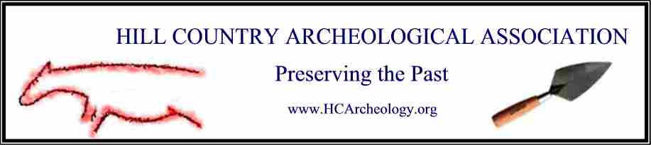
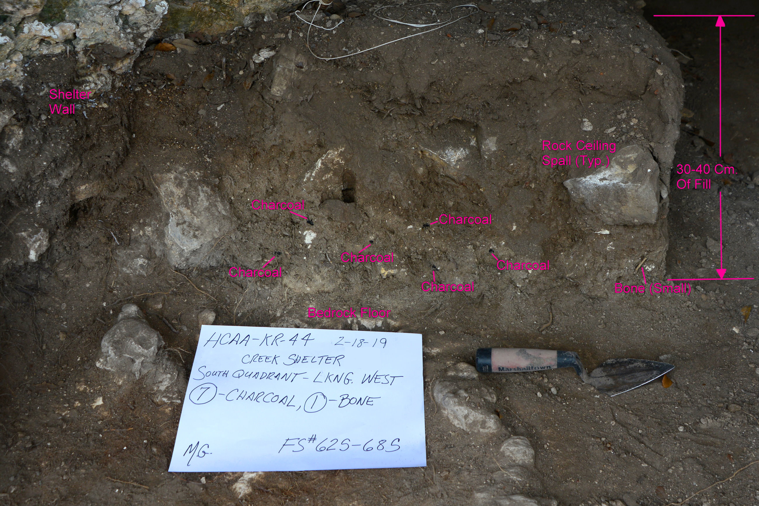
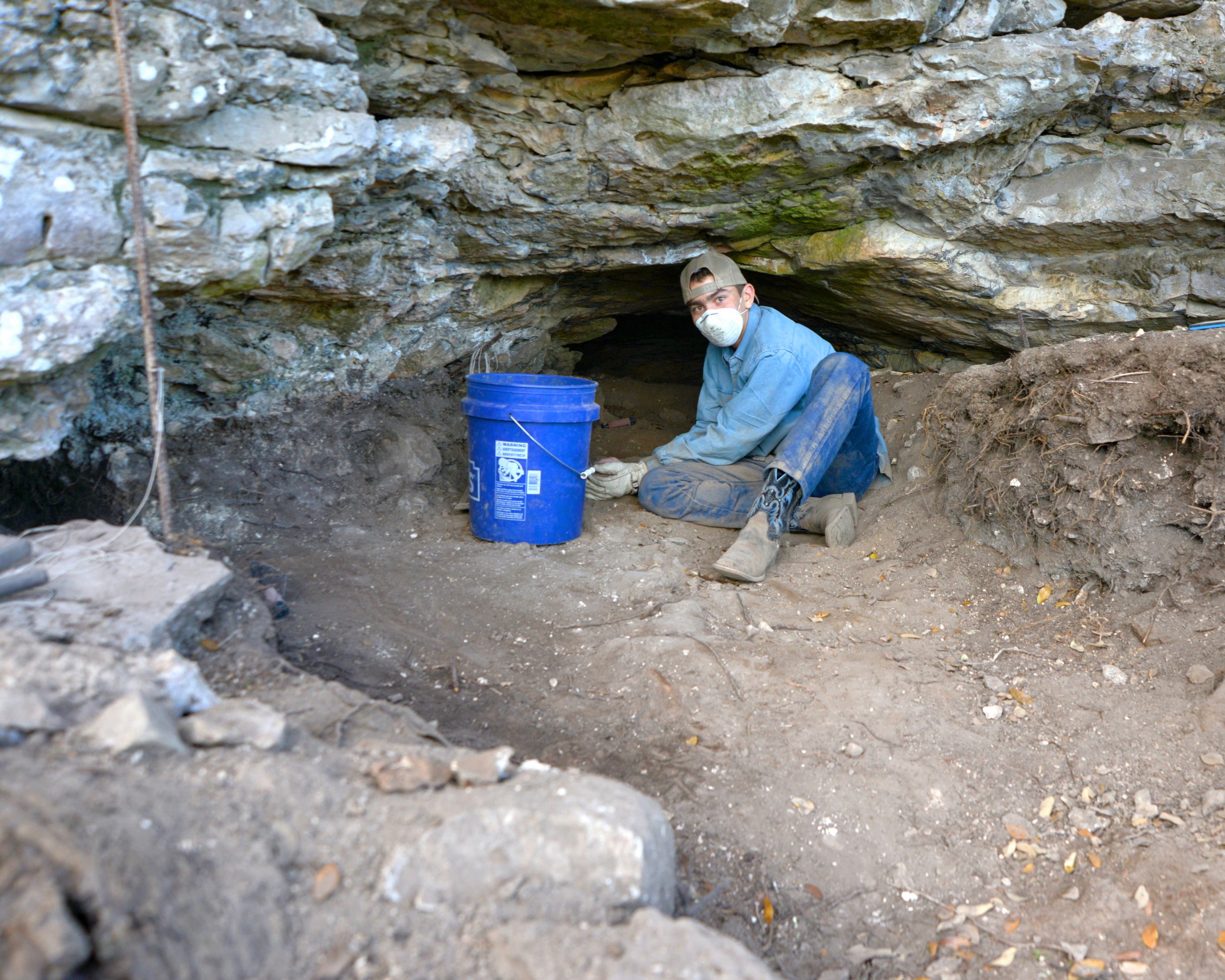
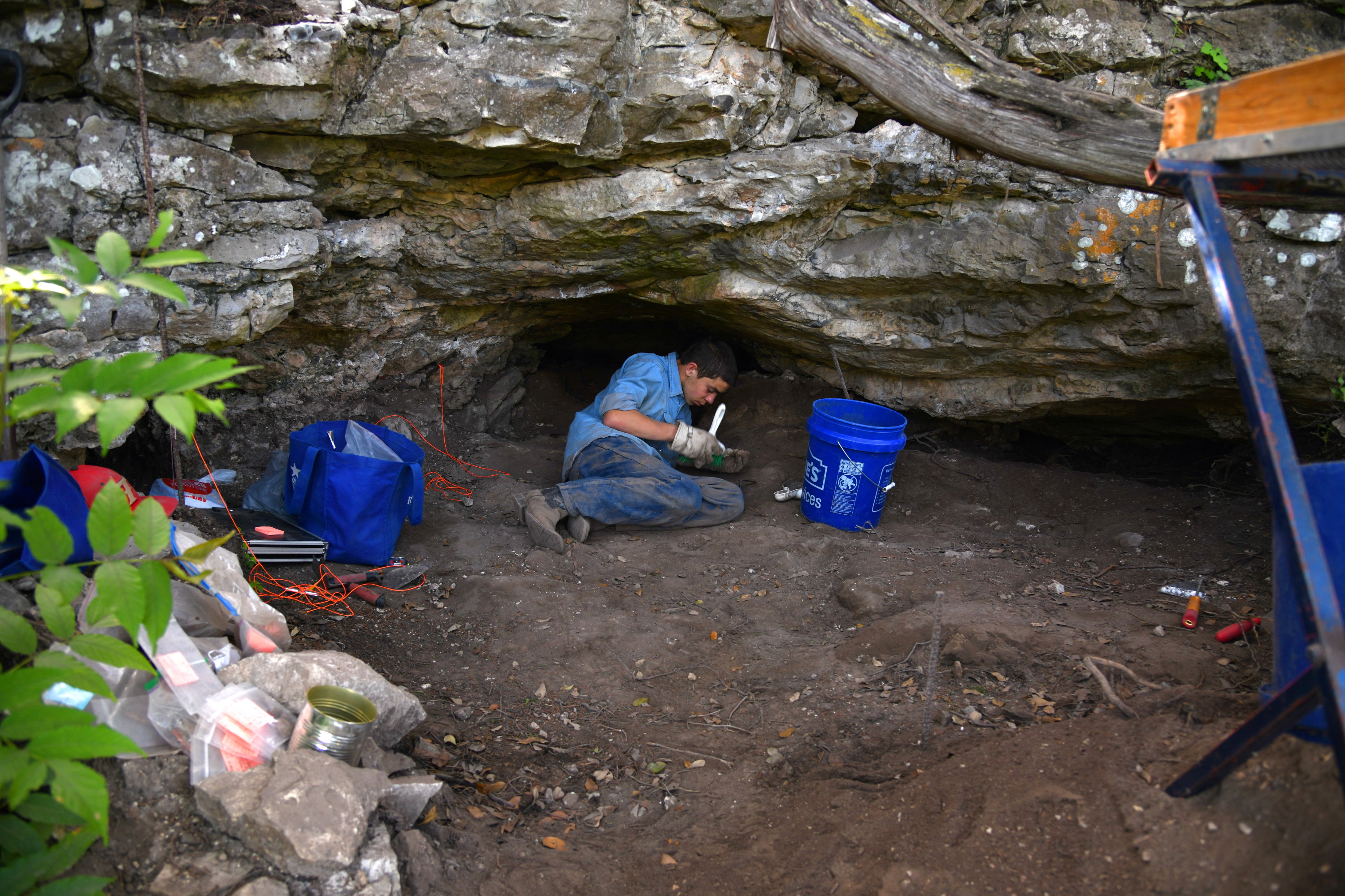
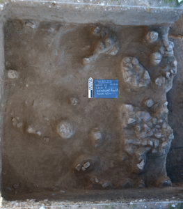
Trei had discovered a small rock shelter with a narrow cave going back into the cliff an unknown distance. Several days later they returned and dug a small test hole just inside the entrance to the shelter, finding several cultural items including a chert core, a biface, and some charcoal. The entrance to the shelter contained dirt fill approximately 30-40 centimeters deep on average. See site photos below.
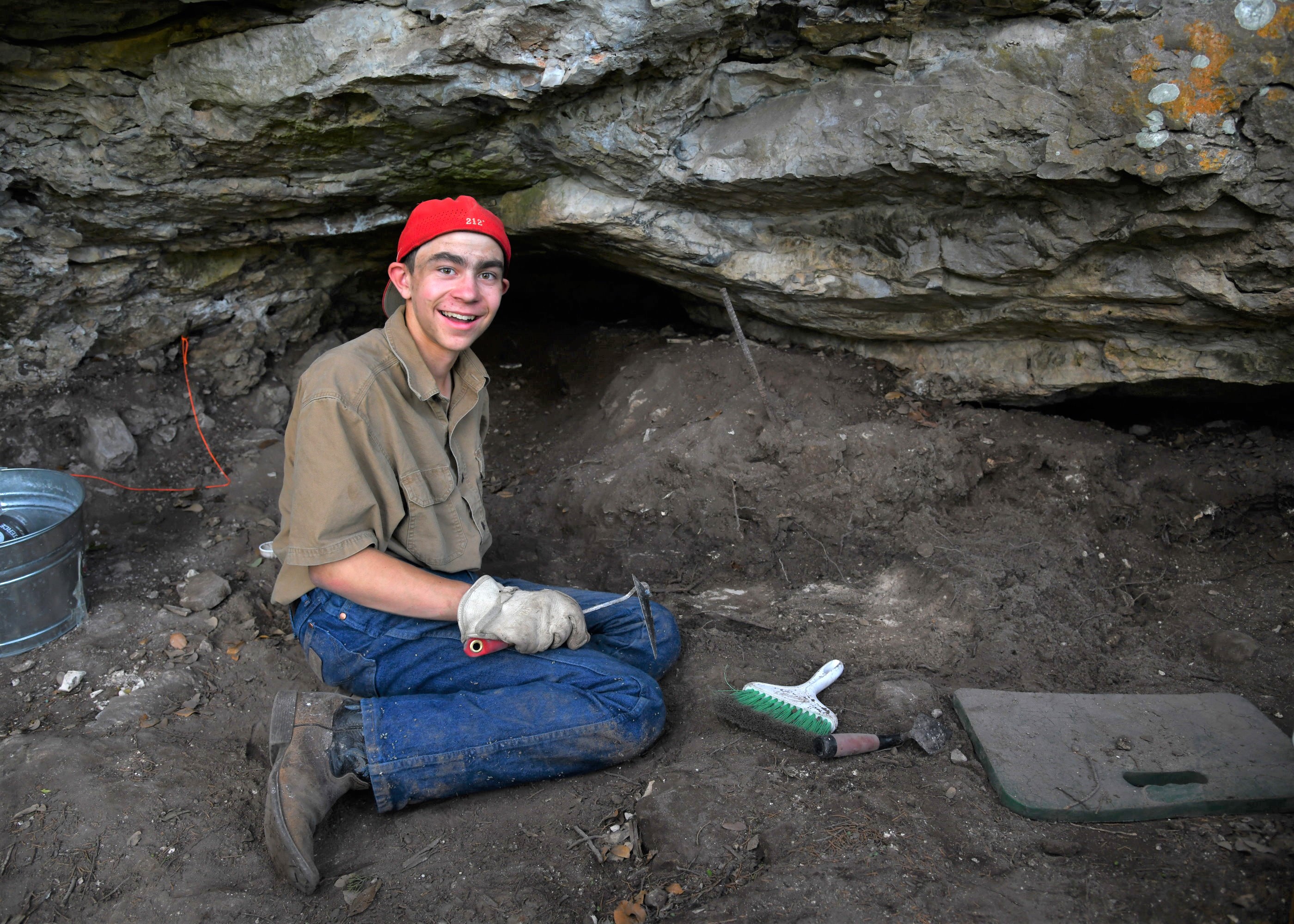
Over the next seven months Marvin and Trei have been returning to the shelter, excavating and recording what they have found, which includes 10 arrow points or parts of points, chert tools, a piece of a broken metate, bone, and numerous areas of charcoal, along with a small intact hearth, complete with charcoal. All the bone found in the shelter appears to have been from small animals, possibly rabbits and squirrels, which prehistoric Indians were apparently cooking in there.
Future excavations will take Trei and Marvin deeper into the cave and to perhaps exciting new discoveries. Depending on what else is found, and if a writeup would be accepted, Trei, 14 years old, plans to submit a paper for publishing and possibly give a presentation at the Texas Archeological Society Annual Meeting in the future.


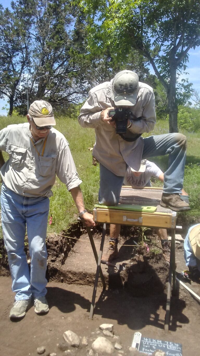
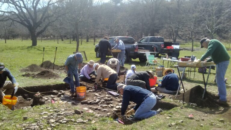
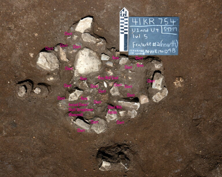
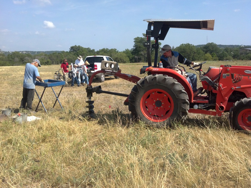
CWR Prehistoric Project-41KR754 (December 2018 through early August 2019)
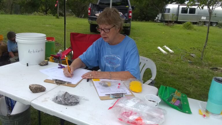
Submitted by: Françoise Wilson, Principal Archeologist
In mid-July of 2018, Marvin Gohlke, Jr., and Craig Mangham performed an initial survey at CWR, a privately-owned ranch in west Kerr County, at the request of the ranch’s owner. In December of the same year, HCAA crew members began to perform hand excavations at CWR. Since then we’ve uncovered a remarkably rich trove of artifacts, tools, bones, mussel shells, ochre, charcoal, and items that are not normally sourced in the area, such as obsidian, several quartz flakes up to 3 cm in diameter, and pottery shards, including four Caddo pottery pieces featuring a characteristic fingernail imprint design.
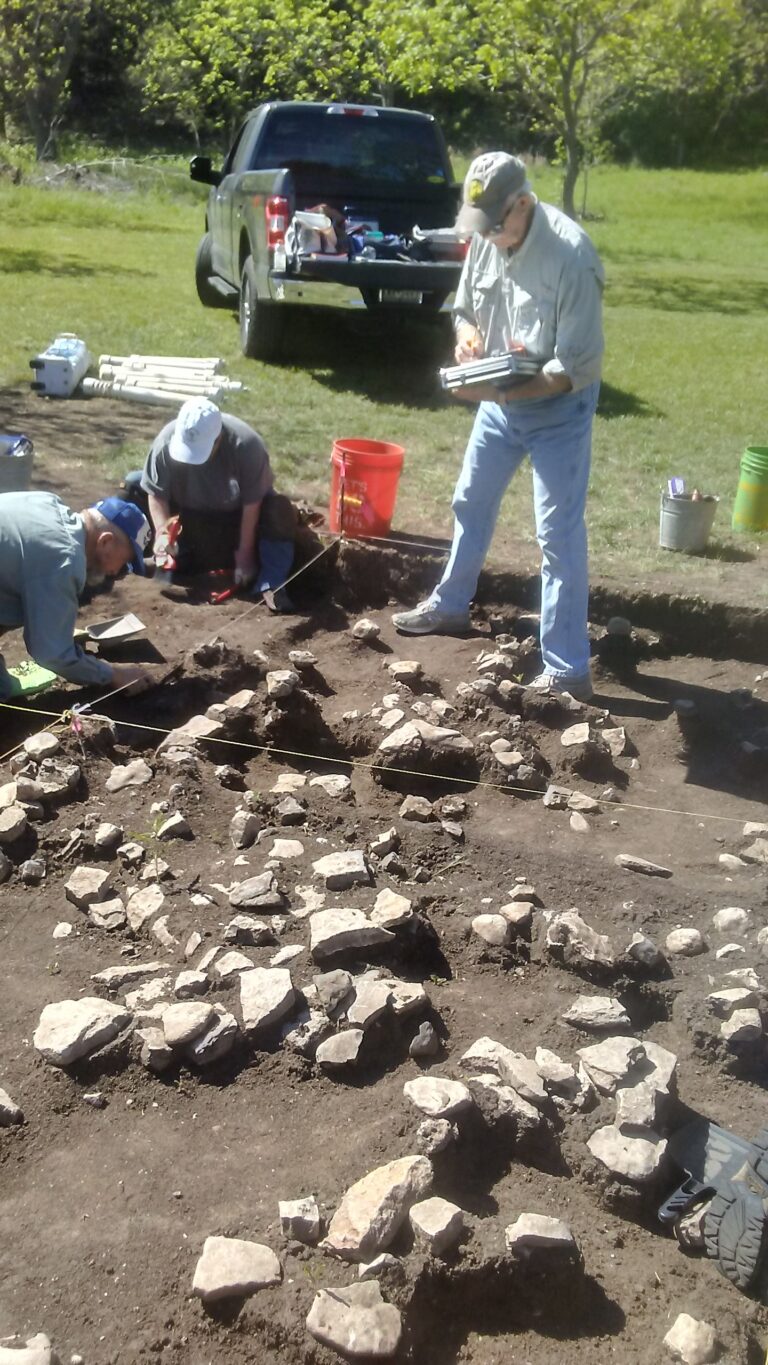
The area of excavations is located on a gently sloping river terrace of the Guadalupe River. The entire southern side of 41KR754 is bordered by a bluff varying from 20-40 ft. in height. To the east of this area a second site, 41KR755, is in a small canyon feeding into the Guadalupe. This site includes a rock shelter with a midden; it has had minimal investigation to date. There are two visible Fire Cracked Rock (FCR) middens in the main area of site 41KR754, which had obviously been a large occupation area.
Excavations to date have yielded discrete FCR hearths in this same area. Additionally, the surface within the area contains scattered FCR and chert lithics. In addition to the lithics there has been a plethora of bison bones recovered in context, including an astragalus, calcaneum, fragments of mandibles, teeth, and many fragments of leg bones. Deer, possible turkey, and small mammal bones, along with a canid—dog or wolf—are also represented here.
Among the dart points that have been recovered are Martindale, Bulverde, Pedernales, Castroville, Montell, Shumla, Marcos, Marshall, Edgewood and Frio. Arrow points include Edwards, Perdiz, Scallorn and Sabinal. There is an impressive number of complete or nearly complete dart and arrow points.
Tools retrieved from excavation and in context include a corner-tang biface, gravers, perforators, spoke shaves and various scrapers. Two incised stone/shaft straighteners have been uncovered, as have countless bifaces, many demonstrating usewear. Most flakes are late stage reduction, with many also indicating usewear and worked edges. Only a few cores have been uncovered.
The two obsidian flakes have been identified as having come from a source in Malad, ID. The original obsidian work pieces would have been transported over 1,200 miles via extensive trade networks in ancient times.
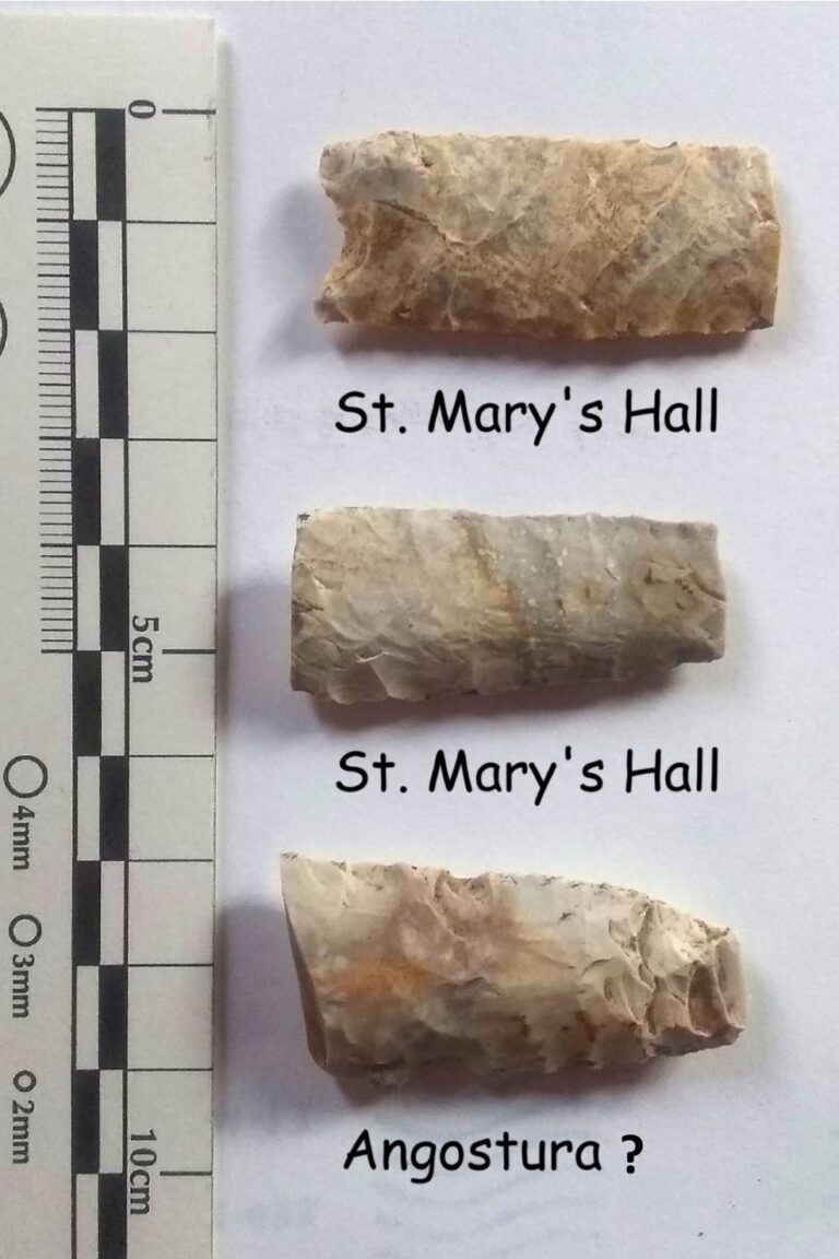
Most recently excavations yielded a broken St. Mary’s Hall dart point in a separate terrace, which is of the Pleistocene Age. Additional investigation in this terrace area have yielded other broken possible Paleo-Indian points.
At this time diagnostic dart and arrow points give this site a temporal span of mid-Paleo-Indian, about 10,000 years ago, to Late Prehistoric, about 800 years ago.
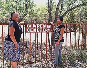
Johann Scherz Homestead and Grave Site Project, September
2018
Johann Scherz arrived on the Texas coast near Indianola with his parents and 5 siblings in 1844 at the age of 20. Johann was also used the name John and Jean Schertz. The family members were immigrants from Alsace, France and likely spoke a unique German dialect similar to Swiss German. They settled in New Braunfels as first families. In 1849 Johann and his brother Sebastian purchased property in what is now Schertz, Texas, a town named after the family. In about 1851 Johann married Segunda Rude and in 1852 they moved to Boerne as first founders there.
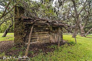
They bought two large lots on Main Street and lived there for several years until 1855 when Johann Patented (a type of homesteading) 160 ac on Spring Creek Road about 3 miles north of Boerne. The family has the distinction of have one of the first European children born in Boerne and being one of the very first German families in Boerne—more firsts for the Schertz family! In 1855 the family moved to the 160 acres, built a cabin, and began farming and ranching. Sadly in 1860, at the age of 36, Johann died suddenly of appendicitis. His wife and children moved back into Boerne and became active in Boerne and elsewhere in Texas for the rest of their lives. Some of their family descendants still live in Boerne, New Braunfels, and Schertz Texas area.
Last summer the current landowner of the original Schertz 160 ac asked HCAA to record the site with the Texas Historical Commission. In the fall of 2018, a team of HCAA members visited, surveyed, recorded the old Johann Schertz homestead.
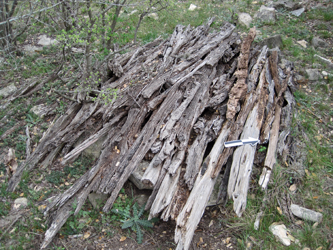
We found a well-marked grave for Johann Scherz, a water well lined with limestone, and the log cabin that Johann had built and in with his family. See the attached photos. His grave site has been nominated as a Texas Historic Cemetery and is awaiting approval by Texas Historical Commission.
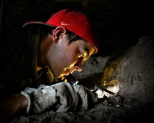
Historic African-American Family Cemetery Project HCAA KE38 (2019)
Have you ever wondered if there were enslaved African-Americans and their slave owners living in Kendall County and the surrounding counties before the Civil War? The answer is, yes! After all, Texas was a confederate state during the civil war—the majority of Texans supported slavery and many owned enslaved African-Americans.
Now you may be wondering, “What happened to these enslaved folks when they were set free?” Or maybe, “What was an enslaved person’s life like here before and after the civil war?” In this article I will discuss the history of the Wren Cemetery—an African-American cemetery—and how it came to be here only 3 miles from Boerne. (Read more with Part 1 article and Part 2 article)
Talk & Tour
Historic Caleb Thomas’ Log Cabin Project HCAA KE37 (2018)
On a bluff overlooking the Cibolo Creek in Boerne there stands today a small one-room log cabin built by Caleb Thomas between 1910 and 1918.
Most of what we know of Caleb is what he told others—his oral history. Caleb was born into a life of enslavement in about 1848 in or near Vicksburg, Mississippi. He was an African-American who served as a house boy to this owner. His owner did not set his slaves free in 1863 as dictated by Lincoln’s Emancipation Proclamation, rather he set Caleb and the rest of his slaves free in 1865 at the end of the Civil War.
Buying and selling African-Americans into enslavement in the USA had been a practice beginning about 1619 in Jamestown. In 1863 there were an estimated 4 million enslaved African-Americans in the USA. In Texas about 30% of the population was estimated to have been enslaved African-Americans. (Read more)
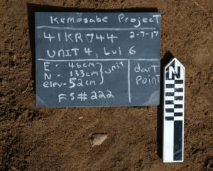
UPDATE ON KEMOSABE PROJECT, April 2018
Kemosabe Project gets first radiocarbon date!
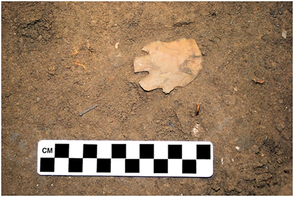
Charcoal from a rock hearth feature at Kemosabe is 7280 to 7420 years old based on C14 radiocarbon dating (calibrated). We have discovered 12 other rock hearths and four larger middens at the site, some also having charcoal, however this latest hearth had the best quality charcoal AND an associated dart point!
Although initially thought to be a "Martindale" , further examination as well as the radiocarbon date suggests that the dart point is a Bandy, whose style was popular in Central Texas 6,000 to 8,000 years ago. The first pyramids in Egypt are thought to have been built 4,600 years ago, so this Bandy point is almost twice as old as the Egyptian pyramids.
After four years of excavation work at the Kemosabe site we have discovered over 100 projectile points, representing 21 dart point types or styles and one arrow point type. Also discovered were 232 bifaces, 68 cores, 18 ground or pecked stone tools and 54,000 flakes—most of the flakes are debitage (waste flakes) produced when the occupants knapped chert tools and projectile points.
Only a small portion of the total Kemosabe site has been excavated but future excavations will, among other things, focus on pushing the site occupation farther back in time to yield calibrated C14 dates earlier than this first one.
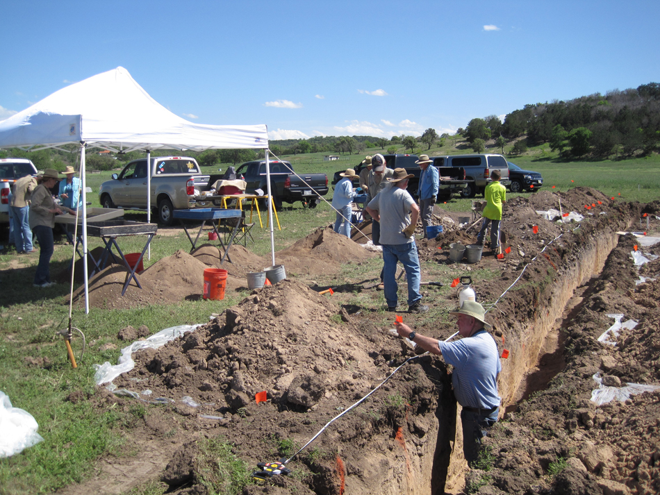
Kemosabe Project - March 2017
Operations continue at the large Kemosabe site and are yielding some valuable information. There have been 25 square meters of excavations so far plus 7 back hoe trench excavations. Diagnostic materials indicate a multi-component site ranging in age from Early Archaic to Late Prehistoric.
Multiple discrete features have been found thus far within the Early Archaic levels and several have associated charcoal, bone and diagnostic lithics. The HCAA has been working this site for 3 1/2 years and there is no end in sight as new and valuable information continues to be revealed from excavations.
 |
 |
 |
Please come join in the fun and discoveries at this large prehistoric site complex! The HCAA crew is working in the lab and/or field weekly. Contact Steve Stoutamire for more information.
Kemosabe Project – February 2016


Even cold, windy conditions at Kemosabe can't stop the progress!!
Operations are continuing at the Kemosabe project. To date over 30 square meters of excavation units have been opened there as well as four back hoe trenches and 92 auger hole tests. Over 12 separate forms of diagnostic dart or arrow points found thus far date the site from lower early archaic to late pre-historic. The latest excavations have revealed several separate hearth features. These and others yet to be found will be examined for charcoal samples to use in radio carbon dating the stratigraphy/occupation surfaces. Select soil samples associated with the hearths are also being collected for flotation analysis to identify plants processed and eaten at the site.
Please come join in the fun and discoveries at this large prehistoric site complex! The HCAA crew is working in the lab and/or field weekly. Contact Kay Woodward or Steve Stoutamire for more information.

Back Hoe Trench To Get Stratigraphic and Cultural Control
Surveys of New Archeology Sites– April 2015
Survey and recording of 10 new sites in Bandera, Kendall, Kerr, and Medina counties are under way on local property
owners land. One owner in southern Medina county has a site with dozens of points ranging from Perdiz arrow points that may be only maybe 4 centuries old to many Middle Archaic point and tools like Kinney, Pedernales, Marshall, and Clear Fork Tools—3,000 to 4,500 year old.
HCAA Field crew continues excavations and Geo-Archeology Studies on Kemosabe Project - February 2015
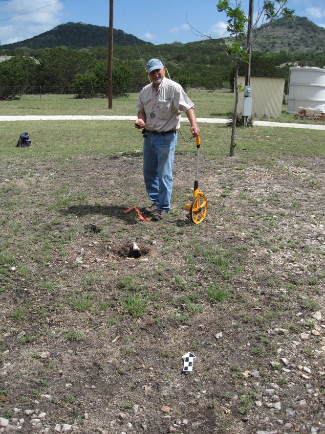
A large grid has been established at the Kemosabe project whose coordinates will be used for trenching operations and later unit excavations over this expansive area of middens and lithic scatters. Cut banks in a creek and a separate arrroyo which cross the property provide excellent exposures to map the stratigraphy of the sediments on the project. Work is underway by the crews to map these exposures and create sedimentary field logs. This, in combination with additional work to examine sediments from select stratigraphic levels, grain size/soil texture, etc. will provide the basis for interpreting sedimentary environments of this area. This geology will be combined with the archeology findings to yield geo-archeology interpretations which can aide in determining occupation levels and their dates within the sediments, etc.
An HCAA Field Crew Begins Recording a Prehistoric Indian Campsite near Sisterdale
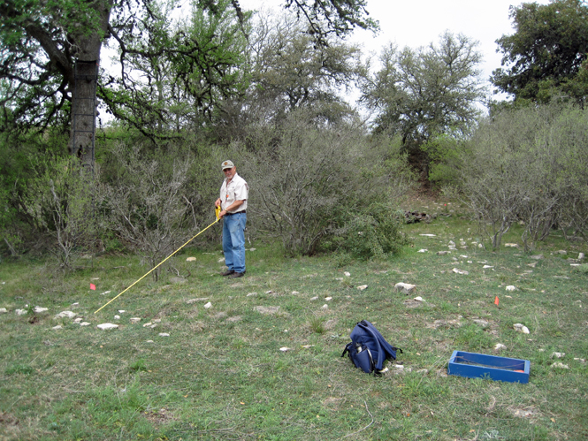
On May 21, 2014 Frank Binetti and John Benedict were invited to visit and record a burned rock midden (=BRM) site, HCAA KE-14, outside of Sisterdale not far from the Guadalupe River. These BRM sites are the remains of hot rock and soil ovens used to cook plants. They were used repeatedly over 1000's of years and gradually the accumulation of fire cracked rock, ash and soil make a mound that is commonly called an "Indian mound" by locals.
This site was discovered several years ago by Frank Binetti and not recorded at that time. The BRM was partially destroyed during the construction of the home and all artifacts uncovered at that time were taken by various construction workers. Thus the owner does not have any diagnostic tools in her possession. John and Frank collected significant artifacts and mapped the BRM and the perimeter of the fairly large camp site that circles the BRM. The campsite is oval and measures 83 meters north-south by 120 meters east-west. In the photo, Frank is in the middle of the midden, which is about 20 meters in diameter and located at 1,500 feet in elevation, with a good view of the area. The BRM is about a meter deep.
The campsite is littered with chert flakes from tool making and some broken tool fragments. On the surface we found and bagged a couple of possible diagnostic tool fragments. The owner has agreed that a test pit can be dug with the purpose of discovering additional diagnostic tools to determine dates when this site was occupied and other information. No date has been set to perform the excavation (Frank Binetti, 5-21-2014).
Crew Revisits Old Site and Discovers 3 New Sites.
On May 1st of 2014, John Benedict and Frank Binetti visited Site 41KE198 that was recorded by Frank in 2008. There were no diagnostics found at the time of the original recording of this site. Diagnostic artifacts tell us how old the site is. The purpose of this new visit was to explore the possibilities of finding diagnostic artifacts and additional burned rock middens. During the exploration, no additional burned rock middens were found, however three distinct lithic scatter areas were discovered, HCAA KE-11, 12 and 13! We spent the next several hours marking off the boundaries of the lithic scatter sites and placed flags to mark their location. During our surveying of Lithic Scatter 1, John found a diagnostic point that we identified as a possible Baker-Gower-Uvalde like point. These point types are from the Early Archaic period, 6,000 to 8,000 years ago—suggesting that the area was occupied during that time.
On May 3rd, John and I returned to record the three lithic scatter sites. We used our compasses, GPS’s, and tape measures to measure and record the sites. We bagged a representation of the lithic scatter from all three sites, and took pictures. A son of the owner requested that we aid in digging a test pit near the original burned rock midden site. The owner and another son showed up and requested that we help in determining where to locate the test pit. We suggested the southeast corner of the BRM and the owner and his sons proceeded to dig and screen for artifacts. At approximately 10 cm down in NE corner the test pit, two broken Montell points were found. These diagnostic points were used by prehistoric Indians during the Late Archaic period, 2,400 to 2,800 years ago. This was a very exciting day for everyone!!
HCAA Field Crew Surveys Historic Shepherd's Home near Boerne
On April 3 and May 2, 2014 Frank Binetti (crew chief) and John Benedict surveyed the remains of a historic 1850's shepherd's home site, HCAA KE-10, near the city of Boerne in Kendall County. This home is on a creek terrace overlooking the original pasture land belonging to George W. Kendall (http://www.tshaonline.org/handbook/online/articles/fke19). It is a short distance from a spring fed creek and on the old Pinta trail. George was known as the "Father of Texas Sheep Ranching" and the person whom Kendall County was named after. One of the first shepherds to work for George was Joe Tait, a sheepherder from Scotland, who likely lived in this home. By 1859 George had approximately 3,500 sheep in his herds.
With metal detectors and visual searching we found large quantities of glass, ceramic and metal fragments on the ground surface near the home. Much of the metal fragments were wire, rusty sheet metal, and fence staples. Square nails were used to nail the wood structure together. The photo on left is of the remains of timbers probably used for walls or roof. They contained the square nails.
The photo on the left is Frank measuring the length of the foundation from east to west. The home was approximately 57 ft x 15 ft with a large fire place on the north west side. Most of the stone foundation and flooring has been removed by the current landowner and used in his modern home construction and as flooring for his patio. This is very common practice for the materials in historic structures to be utilized by later generations (J. Benedict 5-17-2014).
Hill County Archeological Association helps TPWD stabilize prehistoric sites at the Kerr WMA
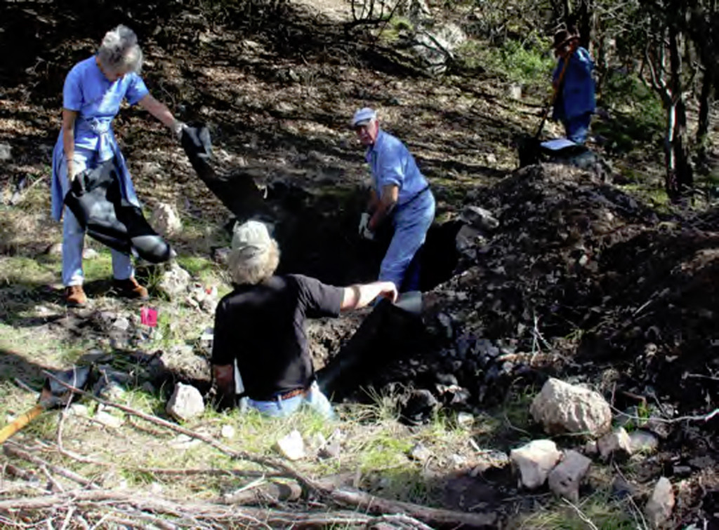
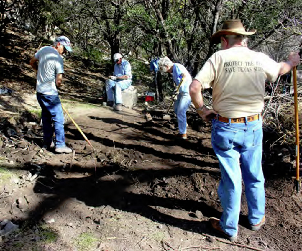
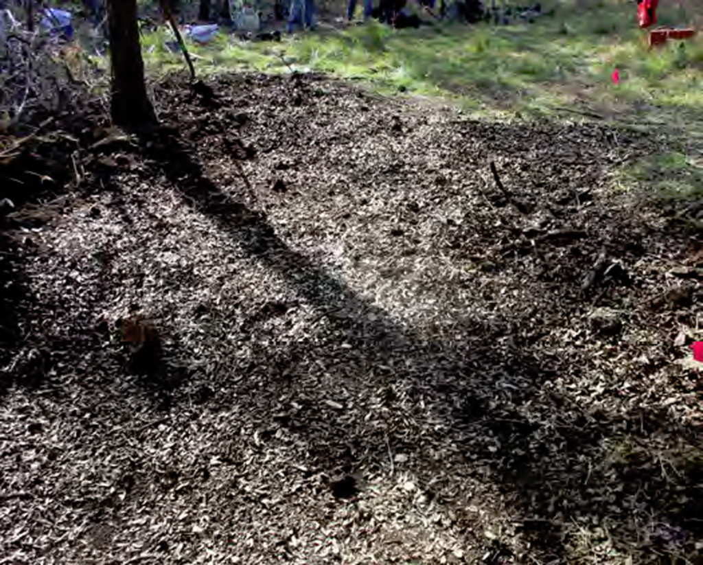
On December 3rd and 4th 2013, six volunteers from the Hill Country Archeological Association along with three from the Texas Archeological Stewards Network of the Texas Historical Commission joined forces with Texas Parks and Wildlife Department staff in stabilizing two prehistoric sites at the Kerr Wildlife Management Area. Both sites have been repeatedly vandalized by artifact collectors despite past efforts from the HCAA volunteers and TPWD staff to curtail looting of these unique ancient campsites reflecting America’s cultural heritage.
In 2010, HCAA helped TPWD in stabilizing vandalism at the Sean site (41KR734) by “limbing-up” the cedar trees growing on site to enhance visibility and refilling holes with tree limbs and earth. The good news is that none of the recent vandal holes expanded from any of the holes refilled a few years before. The bad news is that the vandalism activities are on-going, with recent holes at this site extending to depths of more than one me-ter. The methods of vandalism clearly involved expanding on deep holes that had been dug through the archaeological deposits by cleaving the sheer banks. The damage from such looting activities relates not only from the loss of artifacts kept from public lands, but also from the mixing of the site’s sediments and the destruction of the deposit integrity and mixing of con-texts which scientific excavators use to reconstruct activity patterns and sequences of occupations.
The volunteers mapped, photographed and documented the size and depth of each “pothole”, then marked the basal configuration of each pit. The Looter’s back fill was then shoveled into the pits along with branches and sticks, until the hole was filled. Finally, brush was added to obscure the surface evidence of the pits. A total of 13 potholes with a surface area of almost 32 square meters (343 square feet) required the deposition of 28.5 cubic meters (1,006.6 cubic feet) of burned rocks, branches and sediments to refill the holes at the Sean site. In addition, more than 40 tools, bones, or shell specimens were collected during the refilling efforts. cloths in holes A & B HCAA & Steve Davis
The Hatfield site (41KR439) was less damaged. Eight of 12 vandal pits on the hill slope were refilled with rocks, and sediments from the back dirt pile from the looters. These eight vandal pits had a surface area of about 8 square meters (86 square feet) and a volume of about 1.49 cubic meters (51.2 cubic feet) of displaced sediments. Approximately 45 artifacts, bones and mussel shell were found in the disturbed fill and collected from this site.
The preservation of cultural resource is one of the main missions of TPWD for the enjoyment and research for future generations. TPWD has initiated other monitor-ing measures at these sites in an attempt to identify the looters, but discussions of these measures are be-yond the scope of this note. The results of the stabilization efforts shall be published in the Annual Report to the Texas Historical Commission as part of the agency’s annual permit. TPWD staff is grateful to HCAA for their continued support, and hard work in helping the agency fulfill its mission in preserving the State’s prehistory.
Photos and article by Christopher Lintz, TPWD Cultural Resource Specialist, Wildlife Division, TPWD.
Read more regarding this joint effort.